


Where is Punta Cana?
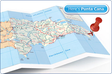
The Dominican Republic occupies the eastern two thirds of the island of Hispaniola in the Caribbean Sea. Haiti occupies the western third of the island. Hispaniola lies at the edge of the tropical zone, resulting in a very consistent climate. That, coupled with its 1400 km. of coastline riddled with beaches has made it an attractive tourist destination.This map of the Dominican Republic shows the mountain chains of the interior and the amazing amount of coastline.
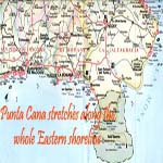
“Where is Punta Cana”? The location of Punta Cana is on the very eastern tip of the Dominican Republic in the province of La Altagracia. Here, the waters of the North Atlantic and the Caribbean Sea meet, creating the ultimate mix of holiday activities. Calm Caribbean beaches for relaxing and slightly rougher waters further out provide excellent water sports. You will not find Punta Cana on most maps because it is the name of one of the beaches in the area, not a town, city or province. However, the Punta Cana tourist destination has become known as composing the following areas, listed from north to south: Macao, Arena Gorda, El Cortecito, Bavaro, Cabeza de Toro, Punta Cana, and Cap Cana (or Juanillo). The nearest city is Higuey,about 30 minutes, a popular day trip from Punta Cana. You should be able to pick out all of these beaches on this map of Punta Cana . This link opens a new window - if it doesn't appear to work hold CTRL and click again (your popup blocker may be stopping it. View Larger Map For more maps of the area click on the following thumbnail maps: The map on the left is a printable road-map of Higuey. The two in the center are Punta Cana resort maps that show the location of resorts, tourist attractions and phone numbers. The Punta Cana map on the far right shows the South Eastern coastline of the Dominican Republic. Map of Higuey: where is Punta Cana? 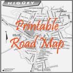


|